
GIS
InfoTech provides complete Geo Spatial solutions to its various customers around the globe. The various GIS services catered by InfoTech help domestic and international clients and governing bodies to have a cutting edge in the market. Our geo spatial services include remote sensing as well as underfloor heating and cooling drafting services.
We offer full range of products and GIS services as far as data management, application development and consulting is concerned. This in- turn helps our clients in successfully planning, implementing and supporting GIS technology and data at their end. We have a unique blend of highly specialized GIS professionals that have extensive experience in the deployment of Geo Spatial Technology due to their diverse experience areas within GIS industry and community.
Our GIS Services

We have a unique blend of highly specialized GIS professionals that have extensive experience in the deployment of Geo Spatial Technology due to their diverse experience areas within GIS industry and community.
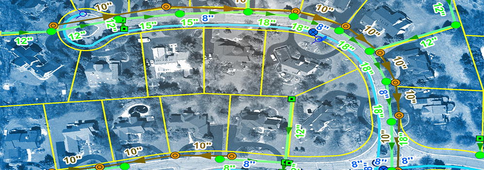
Utility Mapping
Utility mapping deals with mapping the network of electrical, water, gas, sewage & telecom facilities. It includes services, such as system modeling, land base creation, raster to vector map conversion, work order updates, and circuit map creation, executed with top-grade software applications like AutoCAD and MicroStation. Utilizing multiple sources such as satellite pictures, aerial photographs, existing maps, and GPS field data, we expertly generate the GIS database.
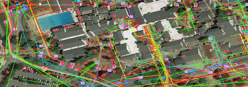
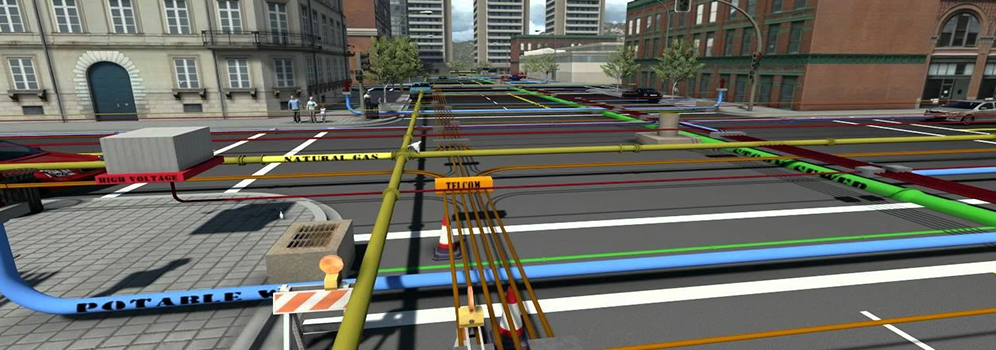
Our utility mapping services include :
- Electrical
- Telecom
- Water
- Gas
And for transmission line we provide:
- LiDAR classification (by voltage and danger)
- Quality Control and flight line adjustment
- 3D Network Modeling and 2D vectorization
- Vegetation management and clearance distances
- PLS-CADD modeling for complete network checking and modeling.
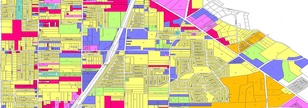
Cadastral Mapping
A cadastral map defines land ownership. It consist of cadastral units, each of which represents a single registered plot of land. The cadastral map shows the boundaries of each cadastral unit, along with the extent of all registered rights. Each cadastral unit is assigned a unique number and, in most cases, this corresponds to the title number for the plot of land.
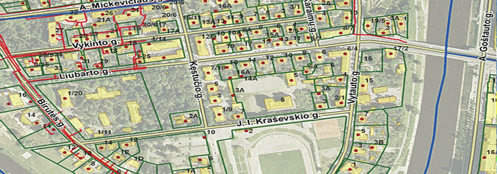
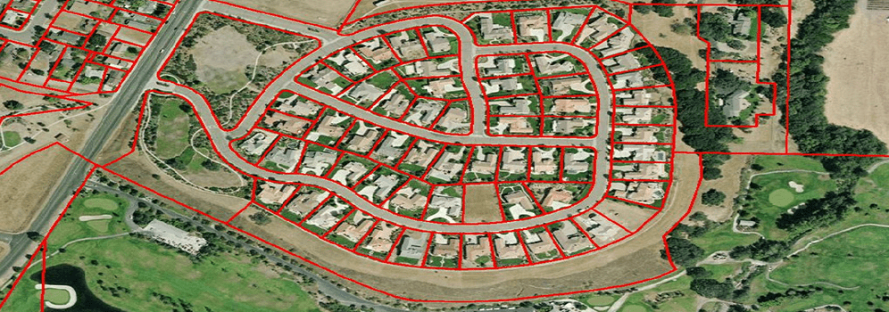
Our Cadastral Mapping Services include :
- Land Records Scanning & Mapping.
- Coordinate Geometry Mapping
- Cadastral Data Integration
- Cadastral/Land Use/ Zoning Integration
- Cadastral Data Maintenance
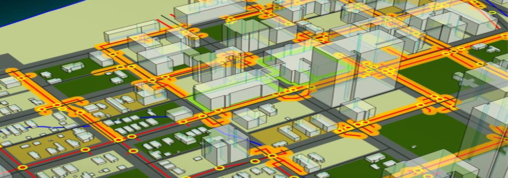
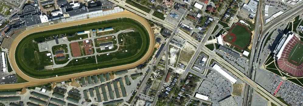
Topographic Mapping
A topographic map is a detailed two-dimensional representation of natural and human-made features on the Earth's surface. These maps are used for camping, hunting, fishing, and hiking to urban planning, resource management, and surveying. The most distinctive characteristic of a topographic map is that the three-dimensional shape of the Earth's surface is modeled by the use of contour lines. Contours are imaginary lines that connect locations of similar elevation. Topographic maps also use a variety of symbols to describe both natural and human made features such as roads, buildings, quarries, lakes, streams, and vegetation.
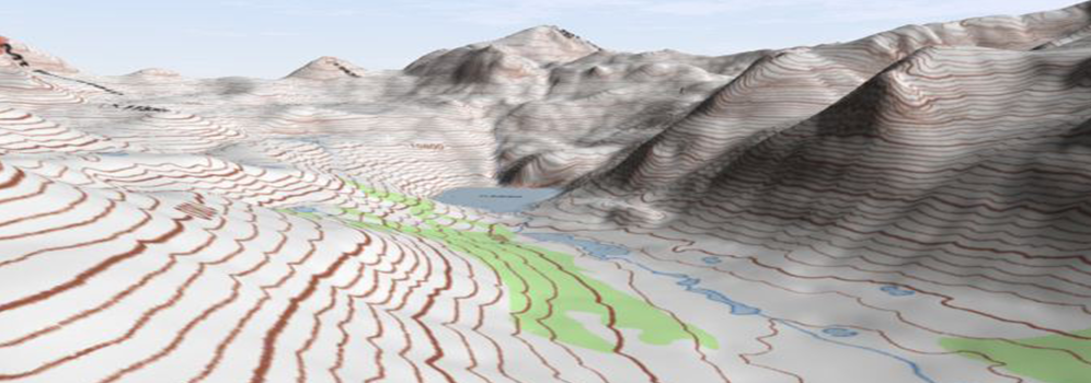
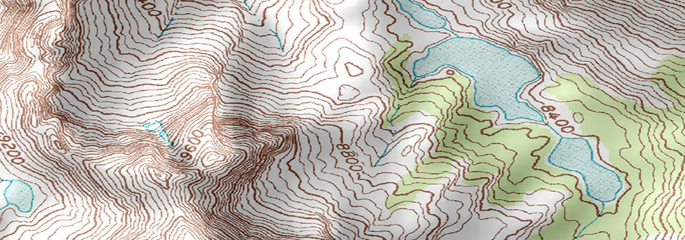
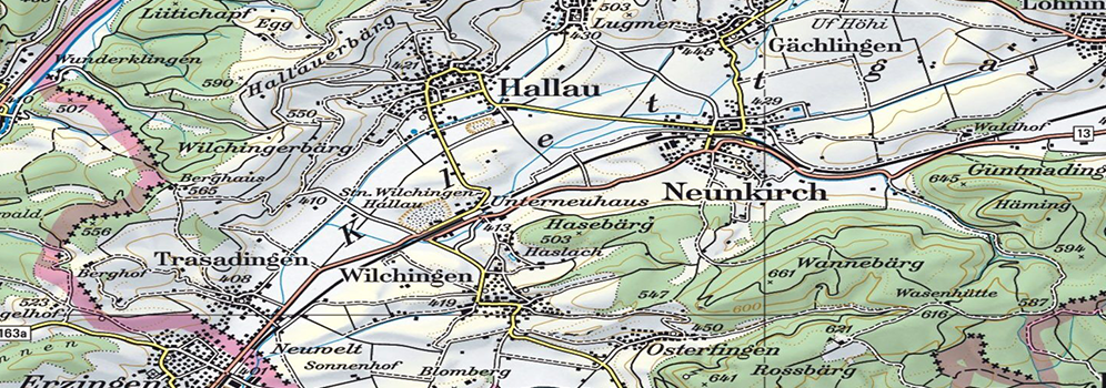
Topographic mapping services includes:
- Orthorectification.
- Aerial Triangulation
- Terrain modeling
- 3D modeling
- Land cover mapping
- LiDAR and much more
Land use/ Land Cover
We acquire landscape for Land management and land planning along with an accurate means of monitoring change over time and provide vital information to any person responsible for land management. Land use and land cover mapping is a process that quantifies current land resources into a series of thematic categories of natural land cover and planned utilization of land.
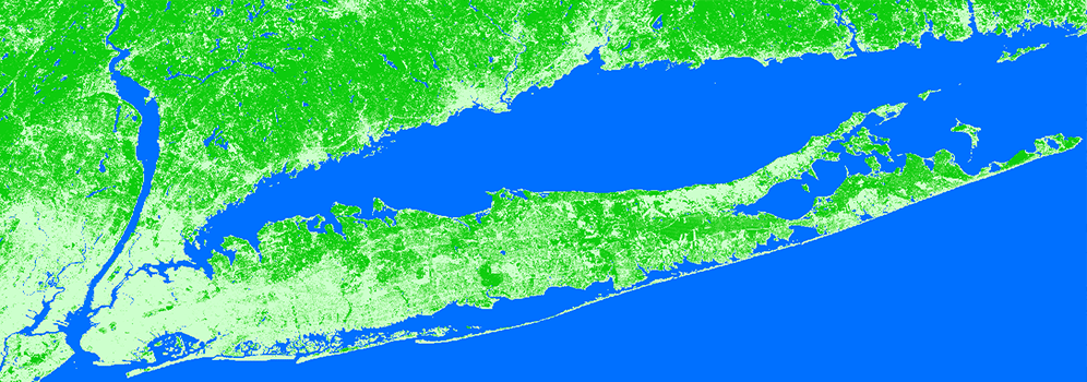

Benefits of Land use & Land cover:
InfoTech understands that changes in land use and land cover are regular, rapid, and so can have significant impacts for people, the economy, and the environment. Among the organizations that will benefit from the information derived from land cover solutions are:
- All government agencies
- Environment and research organizations
- Water departments
- Utility & Engineering firms
- Forestry organizations