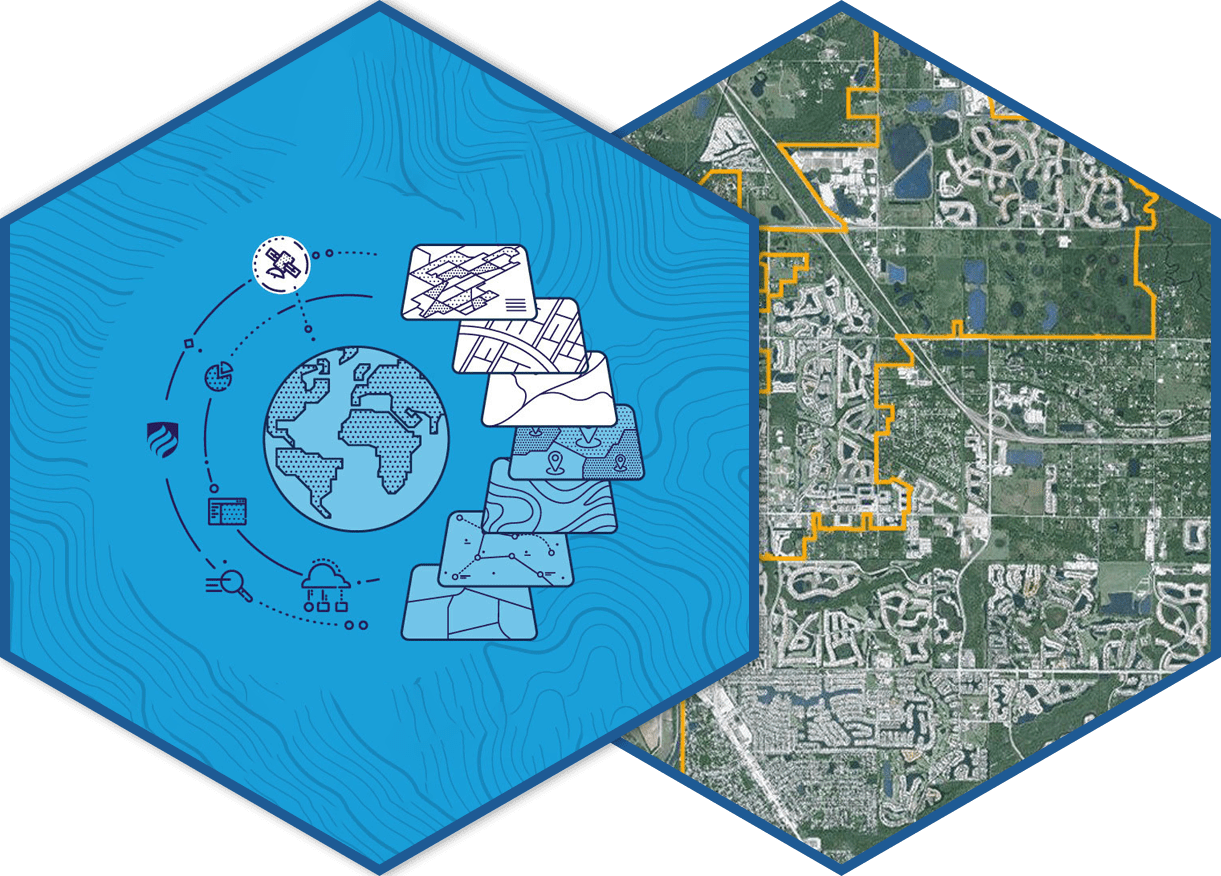
GIS helps to map the spatial location of real-world features and visualize the spatial relationships among them. At InfoTech, we produce profoundly intricate GIS maps to extract vector data so that every inch of the terrain is considered individually. Our company create, store and manage detailed GIS maps based on international standards assuring accurate solutions.
GIS Mapping
Photogrammetry
Photogrammetry is the science of obtaining measurements (metry) using photographs (photogram). It deals with capturing the images of the earth surface. The technique of taking several overlapping images and acquiring measurements from them to produce 3D models of objects or scenes. Under photogrammetry, InfoTech provides pre -processing services such as :
- Aerial Triangulation
- DTM Generation
- Planimetric Mapping
- Orthophoto Generation
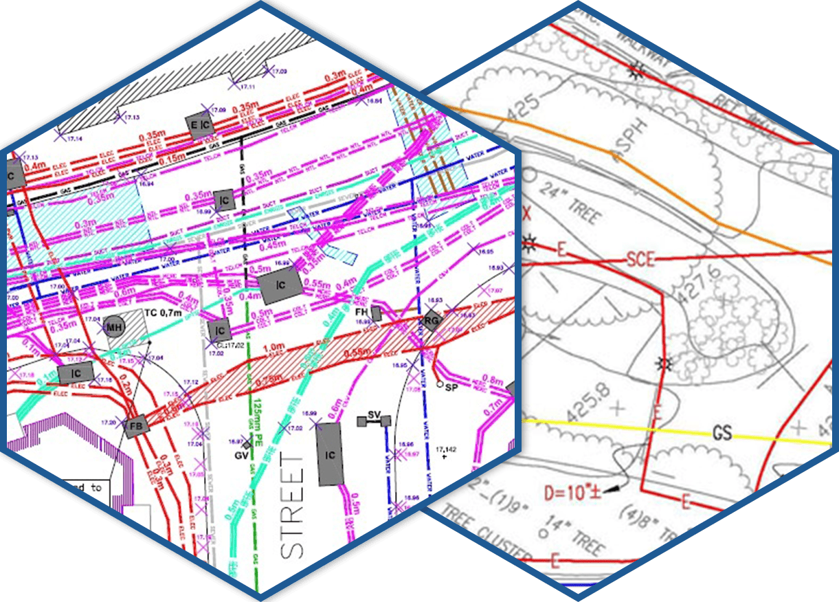
Utility Mapping
The utility is one of the wide growing sectors. And utility mapping is one of the fundamental requirements of modern infrastructure management. Elements of utility should be break free and managing manually is a very challenging task, so geospatial data gives spatial dimensions to its management. GIS-based data management systems and solutions developed by InfoTech team help the Utility providers to leverage operational efficiency, provide superior services and manage cost-effectively.
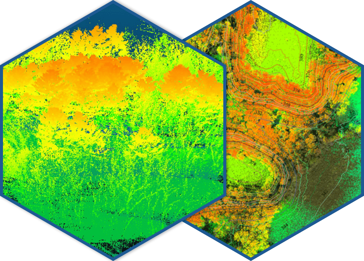
LiDAR
InfoTech combines LiDAR with GIS data and other survey information to generate complex geomorphic structure mapping products, advanced 3D models/earthwork profiles, rendering of structures, and many additional high-value mapping products. We offer post-processing of LiDAR point cloud data include Bare earth, utility, topographic and land use classification. We seamlessly integrate LiDAR data with other data sets, including Orthophoto imagery.
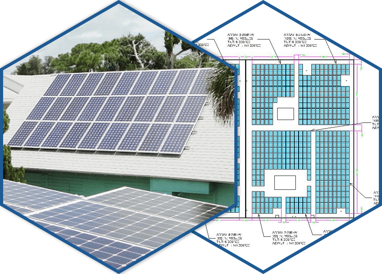
Solar Drafting
InfoTech supports the expansion of solar technologies globally and has extensive and unique expertise in the solar technologies and photovoltaic solar installation industry. We prepare all kinds of Solar Panel Layout drawings, right from the site plans to the mounting planes, conduit layouts, structural designing calculations etc. Our prototype layouts set a frame in installer mind and give an idea for the right direction of dotting the solar panel and proper dimensions. Our layout designing will further help in deciding the capacity of a solar installation and the budget extent.
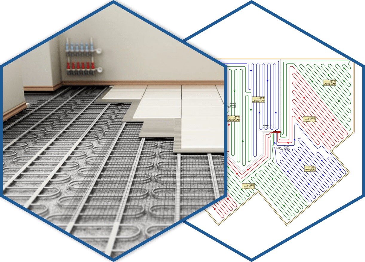
Under Floor Heating & Cooling
We design under control heating and cooling system following the specification detailed by clients. Our company is successfully working with global clients for UFH designing due to our flexible approx. and quality solutions. We provide complete Under Floor Heating system design, specification details and layout drawings. Our Estimation / Quotation Services are very cost-effective.